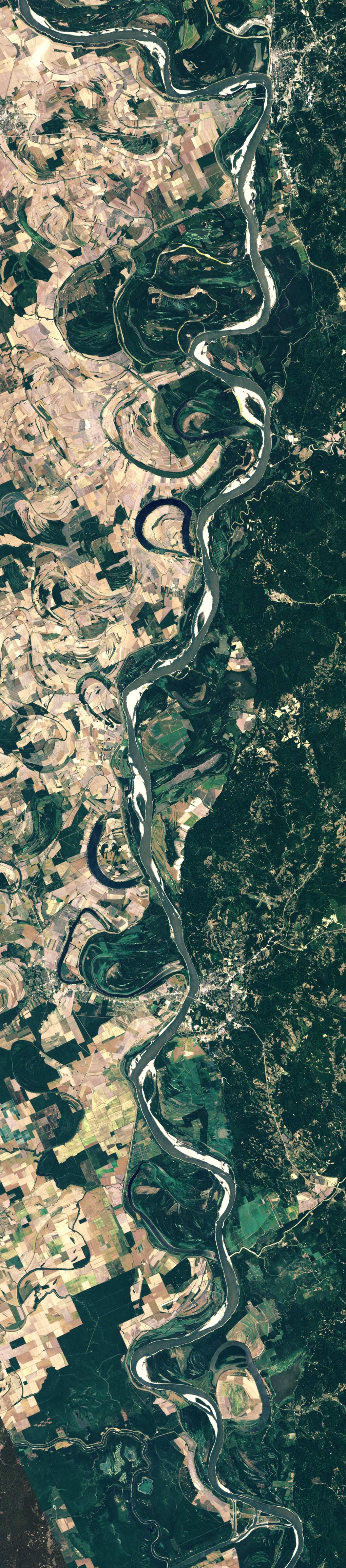
'The delta switching has occurred every 1,000 years or so in the past. As sediment accumulates in the main channel, the elevation increases, and the channel becomes more shallow and meandering. Eventually the river finds a shorter, steeper descent to the Gulf. In the 1950s, engineers noticed that the river’s present channel was on the verge of shifting westward to the Atchafalaya River, which would have become the new route to the Gulf. Because of the industry and other development that depended on the present river course, the U.S. Congress authorized the construction of the Old River Control Structure to prevent the shift from happening.' - 'Mississippi Meanders', August 31, 2006 Earth Observatory, Nasa

A blog compiled by Neeve and Claire which tends to feature; screenshots | internet diversions | lens media | fashion | fluorescent lights | maps | extra large google image search | detail shots | dead ends | gold | faux bois | suburbs at night | spotlights | dogs | Russia | Ciara | palm trees | film stills | the aesthetics of rugby | music videos | colour palettes | aerial photography | adornment |
No comments:
Post a Comment